Geolocate

Sayulita topographic map

Click on the map to display elevation.

About this map

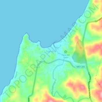
Name: Sayulita topographic map, elevation, terrain.

Location: Sayulita, Bahía de Banderas, Nayarit, 63132, Mexico (20.84893 -105.46070 20.88893 -105.42070)

Average elevation: 38 m

Minimum elevation: -1 m

Maximum elevation: 163 m

Other topographic maps

Click on a map to view its topography, its elevation and its terrain.

arroyo

Mexico > Nayarit > Bahía de Banderas > Compostela > Ursulo Galvan

Average elevation: 27 m

Gear up for your next adventure:

🍽️Titanium Camping Spork - Ultralight and indestructible eating utensil
🧰Multitool Knife - Compact and versatile tool for outdoor use
🥾Waterproof Trail Shoes - Shoes designed to handle wet terrain
🗺️Topographic Maps - Detailed maps to explore trails, mountains, and wilderness areas
🚑Survival Whistle - Signal for help across long distances in mountains

As an Amazon Associate, this site earns from qualifying purchases at no extra cost to you.