Geolocate

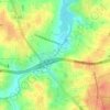
Quaker Acres topographic map

Click on the map to display elevation.

About this map

Name: Quaker Acres topographic map, elevation, terrain.

Location: Quaker Acres, Greensboro, Guilford County, North Carolina, 27410, United States (36.07514 -79.92559 36.11514 -79.88559)

Average elevation: 269 m

Minimum elevation: 235 m

Maximum elevation: 300 m

Other topographic maps

Click on a map to view its topography, its elevation and its terrain.
Gear up for your next adventure:

🐕Hiking Dog Pack - Let your canine companion carry their own water and food
🥾Mountain Hiking Boots - High-traction boots for rocky terrain
🕶️Polarized Sunglasses - Protect your eyes with durable polarized lenses
🔦LED Flashlight - Powerful and long-lasting flashlight for camping and emergencies
🥾Trekking Poles - Adjustable trekking poles to reduce knee stress and improve stability

As an Amazon Associate, this site earns from qualifying purchases at no extra cost to you.