Geolocate

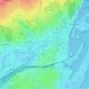
Thorning topographic map

Click on the map to display elevation.

About this map

Name: Thorning topographic map, elevation, terrain.

Location: Thorning, Silkeborg Municipality, Central Denmark Region, Denmark (56.26513 9.31075 56.30513 9.35075)

Average elevation: 67 m

Minimum elevation: 47 m

Maximum elevation: 79 m

Other topographic maps

Click on a map to view its topography, its elevation and its terrain.

Øby

Denmark > Central Denmark Region

Average elevation: 15 m

Anholt

Denmark > Central Denmark Region

The western fifth of Anholt consists of hilly moraine country, while the eastern four-fifths of the island consist of mostly flat raised seabed with some low hills, former wind-blown sand dunes. Only the western moraine hills are inhabited. The eastern part, called "Ørkenen" (The Desert) is treeless; the…

Average elevation: 2 m
Samsø

Denmark > Central Denmark Region

Average elevation: 2 m
Karup Å

Denmark > Central Denmark Region

Average elevation: 57 m

Rimsø

Denmark > Central Denmark Region

Average elevation: 32 m

Julsø

Denmark > Central Denmark Region > Laven

Average elevation: 65 m

Nørrestrand

Denmark > Central Denmark Region > Horsens

Average elevation: 14 m

Glesborg

Denmark > Central Denmark Region

Average elevation: 39 m

Tunø

Denmark > Central Denmark Region

Average elevation: 2 m

Begtrup Vig

Denmark > Central Denmark Region

Average elevation: 9 m

Mølleparken

Denmark > Central Denmark Region > Aarhus

Average elevation: 17 m

Gear up for your next adventure:

🎒Backpack Rain Cover - External shield to keep your entire pack dry
🔭Compact Monocular - One-handed bird watching and trail spotting
🏃Hydration Running Vest - Carry water and maps close to your body for speed
🧳Compression Sacks - Maximize space in your backpack by shrinking gear
🥾Trail Running Shoes - Lightweight and durable shoes for trail running

As an Amazon Associate, this site earns from qualifying purchases at no extra cost to you.