Geolocate

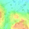
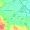
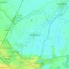
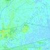
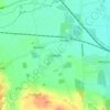
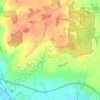
Ufford topographic map

Click on the map to display elevation.

About this map

Name: Ufford topographic map, elevation, terrain.

Location: Ufford, City of Peterborough, Cambridgeshire and Peterborough, England, United Kingdom, Southey Wood (52.60742 -0.36723 52.61179 -0.36120)

Average elevation: 45 m

Minimum elevation: 18 m

Maximum elevation: 58 m

Other topographic maps

Click on a map to view its topography, its elevation and its terrain.
Ufford

United Kingdom > England > City of Peterborough

Average elevation: 33 m

Etton

United Kingdom > England > City of Peterborough

Average elevation: 12 m

Sutton

United Kingdom > England > City of Peterborough

Average elevation: 26 m

Barnack

United Kingdom > England > City of Peterborough

Average elevation: 33 m

Bainton

United Kingdom > England > City of Peterborough

Average elevation: 23 m

Eye

United Kingdom > England > City of Peterborough

Average elevation: 5 m

Marholm

United Kingdom > England > City of Peterborough

Average elevation: 18 m

Castor

United Kingdom > England > City of Peterborough

Average elevation: 25 m

Ashton

United Kingdom > England > City of Peterborough

Average elevation: 21 m

Upton

United Kingdom > England > City of Peterborough

Average elevation: 38 m

Maxey

United Kingdom > England > City of Peterborough

Average elevation: 11 m

Etton

United Kingdom > England > City of Peterborough

Average elevation: 12 m

Gear up for your next adventure:

🥾Trail Running Shoes - Lightweight and durable shoes for trail running
👟Trail Running Shoes - Agile footwear for fast-paced topographic exploration
🧴Insect Repellent - Protect yourself from bugs during outdoor adventures
👟Sport Hiking Sandals - Breathable footwear for water crossings and camp rest
🧴Waterproofing Spray - Restore the DWR coating on jackets and tents

As an Amazon Associate, this site earns from qualifying purchases at no extra cost to you.