Geolocate

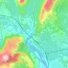
Jacou topographic map

Click on the map to display elevation.

About this map

Name: Jacou topographic map, elevation, terrain.

Location: Jacou, Montpellier, Hérault, Occitania, Metropolitan France, 34830, France (43.65414 3.89905 43.67543 3.92846)

Average elevation: 64 m

Minimum elevation: 29 m

Maximum elevation: 110 m

Other topographic maps

Click on a map to view its topography, its elevation and its terrain.
Portiragnes Plage

France > Occitania > Hérault > Portiragnes

Average elevation: 2 m

Rabieux

France > Occitania > Hérault > Ceyras

Average elevation: 123 m

Saint-Jean d'Aureilhan

France > Occitania > Hérault > Béziers

Average elevation: 39 m

Place de la Mairie

France > Occitania > Hérault > Marseillan

Average elevation: 7 m

Gear up for your next adventure:

🧦Hiking Liner Socks - Thin base layer to prevent friction and blisters
🚲Bike Repair Kit - Essential tools for on-trail mechanical issues
🥾Trail Hiking Socks - Comfortable socks to prevent blisters and fatigue
🧴Outdoor Sunscreen - High SPF protection for high-altitude UV exposure
☕Camping Coffee Maker - Brew fresh coffee anywhere on the topographic map

As an Amazon Associate, this site earns from qualifying purchases at no extra cost to you.