Geolocate

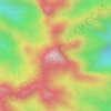
Jinotega topographic map

Click on the map to display elevation.

About this map

Name: Jinotega topographic map, elevation, terrain.

Location: Jinotega, 65000, Nicaragua (12.99428 -86.11693 13.34088 -85.72032)

Average elevation: 962 m

Minimum elevation: 338 m

Maximum elevation: 1,654 m

Other topographic maps

Click on a map to view its topography, its elevation and its terrain.

Cerro Cubulcán

Nicaragua > Jinotega

Average elevation: 1,115 m

Los Rayos

Nicaragua > Jinotega

Average elevation: 402 m

Distrito I

Nicaragua > Jinotega > El Boniche

Average elevation: 1,232 m

Cerro El Picacho

Nicaragua > Jinotega > Jinotega

Average elevation: 1,220 m

Cerro Kilambé

Nicaragua > Jinotega > El Cuá

Average elevation: 1,432 m

Gear up for your next adventure:

🥾Approach Boots - Comfortable boots for hiking and climbing approaches
🧤Insulated Winter Gloves - Heavy-duty protection for sub-zero Canadian adventures
🥾Trail Hiking Shoes - Durable shoes designed for rugged trails
🦶Hiking Shoe Insoles - Added support for high arches and long days on feet
🧭GPS Handheld Device - Reliable GPS navigation for outdoor adventures

As an Amazon Associate, this site earns from qualifying purchases at no extra cost to you.