Geolocate

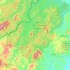
Cerro Cubulcán topographic map

Click on the map to display elevation.

About this map

Name: Cerro Cubulcán topographic map, elevation, terrain.

Location: Cerro Cubulcán, Jinotega, 65000, Nicaragua (13.07518 -85.99925 13.07528 -85.99915)

Average elevation: 1,115 m

Minimum elevation: 1,005 m

Maximum elevation: 1,401 m

Other topographic maps

Click on a map to view its topography, its elevation and its terrain.

Jinotega

Nicaragua > Jinotega

Average elevation: 962 m

Suti Tingni

Nicaragua > Jinotega

Average elevation: 405 m

Santa Carmela

Nicaragua > Jinotega

Average elevation: 1,487 m

San José de Bocay

Nicaragua > Jinotega

Average elevation: 351 m

La Fundadora

Nicaragua > Jinotega > Jinotega

Average elevation: 1,272 m

Gear up for your next adventure:

📷Outdoor Action Camera - Capture high-elevation views and rugged adventures
🧳Compression Sacks - Maximize space in your backpack by shrinking gear
🥾Lightweight Hiking Boots - Boots for comfort and mobility on long hikes
⛺Bushcraft Tarp - Versatile emergency shelter or gear protection
☕Camping Coffee Maker - Brew fresh coffee anywhere on the topographic map

As an Amazon Associate, this site earns from qualifying purchases at no extra cost to you.