Geolocate

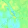
Carpenter Township topographic map

Click on the map to display elevation.

About this map

Name: Carpenter Township topographic map, elevation, terrain.

Location: Carpenter Township, Itasca County, Minnesota, United States (47.80614 -93.46679 47.89483 -93.08098)

Average elevation: 413 m

Minimum elevation: 364 m

Maximum elevation: 459 m

Other topographic maps

Click on a map to view its topography, its elevation and its terrain.
Togo

United States > Minnesota > Itasca County

Average elevation: 408 m

Upper Twin Lakes

United States > Minnesota > Itasca County > Rosy

Average elevation: 409 m

Gear up for your next adventure:

🧶550 Survival Paracord - Versatile utility cord for emergency repairs and rigging
🧳Compression Sacks - Maximize space in your backpack by shrinking gear
⛺Camping Essentials - All-in-one gear for a comfortable camping trip
🚲MTB Frame Bag - Carry tools and maps directly on your bicycle frame
🦶Anti-Blister Balm - Prevents friction and hotspots during long ascents

As an Amazon Associate, this site earns from qualifying purchases at no extra cost to you.