Geolocate

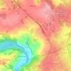
Paderne topographic map

Click on the map to display elevation.

About this map

Name: Paderne topographic map, elevation, terrain.

Location: Paderne, Bazar, Lugo, Galicia, 27210, España (42.92234 -7.62774 42.96234 -7.58774)

Average elevation: 581 m

Minimum elevation: 474 m

Maximum elevation: 671 m

Other topographic maps

Click on a map to view its topography, its elevation and its terrain.
Teixeiro

España > Galicia > Lugo > Lugo

Average elevation: 526 m

Meilán

España > Galicia > Lugo > Lugo

Average elevation: 456 m

Carballido

España > Galicia > Lugo > Lugo

Average elevation: 506 m

Coeses

España > Galicia > Lugo > Lugo

Average elevation: 447 m

Vilachá

España > Galicia > Lugo > Lugo

Average elevation: 527 m

Gear up for your next adventure:

🛶Kayak Dry Bag - Waterproof storage for kayaking adventures
🧭GPS Tracker - Track your location in remote areas safely
🧴First Aid Kit - Essential first aid supplies for outdoor emergencies
🚲MTB Frame Bag - Carry tools and maps directly on your bicycle frame
🧢Outdoor Cap - Protective cap for sun and rain during hikes

As an Amazon Associate, this site earns from qualifying purchases at no extra cost to you.