Geolocate

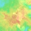
Castella topographic map

Click on the map to display elevation.

About this map

Name: Castella topographic map, elevation, terrain.

Location: Castella, Agen, Lot-et-Garonne, Nouvelle-Aquitaine, Metropolitan France, 47340, France (44.29028 0.64068 44.33462 0.71929)

Average elevation: 190 m

Minimum elevation: 105 m

Maximum elevation: 238 m

Other topographic maps

Click on a map to view its topography, its elevation and its terrain.
Marry

France > Nouvelle-Aquitaine > Lot-et-Garonne > Veyries > Saint-Gény

Average elevation: 127 m

Message

France > Nouvelle-Aquitaine > Lot-et-Garonne > Antagnac

Average elevation: 144 m

Sous Chays

France > Nouvelle-Aquitaine > Lot-et-Garonne > Pujols

Average elevation: 102 m

Gear up for your next adventure:

💡Solar Camping Lamp - Eco-friendly lighting for campsites
🧦Crew Hiking Socks - Comfortable socks for long-distance hikes
🚲Heavy Duty Bike Lock - Secure your bike at the trailhead or during stops
🧭GPS Tracker - Track your location in remote areas safely
🩹Compact First Aid Kit - Pre-packed essentials for common trail injuries

As an Amazon Associate, this site earns from qualifying purchases at no extra cost to you.