Geolocate

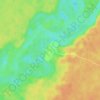
Madre de Dios topographic map

Click on the map to display elevation.

About this map

Name: Madre de Dios topographic map, elevation, terrain.

Location: Madre de Dios, Province of Manú, Madre de Dios, Peru (-13.27105 -71.28258 -12.06421 -70.03740)

Average elevation: 432 m

Minimum elevation: 207 m

Maximum elevation: 3,661 m

Other topographic maps

Click on a map to view its topography, its elevation and its terrain.
San Fracisco

Peru > Madre de Dios > Las Piedras

Average elevation: 246 m

Puerto Maldonado

Peru > Madre de Dios

Average elevation: 200 m

Puerto Luz

Peru > Madre de Dios > Madre de Dios

Average elevation: 270 m

Gear up for your next adventure:

🥾Hiking Shorts - Breathable shorts suitable for summer hikes
🚲Handlebar Phone Mount - View topographic-map.com live while cycling
🥾Trail Hiking Shoes - Durable shoes designed for rugged trails
🛁Quick-Dry Microfiber Towel - Space-saving towel that dries rapidly on the move
👟Leg Gaiters - Keep debris, mud, and snow out of your boots

As an Amazon Associate, this site earns from qualifying purchases at no extra cost to you.