Geolocate

Farningham topographic map

Click on the map to display elevation.

About this map
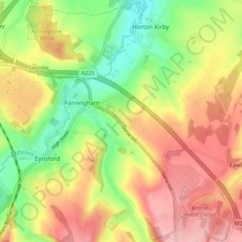
Name: Farningham topographic map, elevation, terrain.

Location: Farningham, Sevenoaks, Kent, England, United Kingdom (51.35143 0.19052 51.39803 0.25605)

Average elevation: 89 m

Minimum elevation: 16 m

Maximum elevation: 159 m

Gear up for your next adventure:

🛏️Camping Sleeping Mat - Comfortable mats for sleeping outdoors
🥾Waterproof Hiking Boots - Essential footwear for rugged terrain and wet Canadian trails
🥾Mountaineering Boots - Supportive boots for climbing and high-altitude hiking
🧥Fleece Jacket - Warm and lightweight jacket for layering
🥾Light Trekking Boots - Supportive boots for multi-day treks

As an Amazon Associate, this site earns from qualifying purchases at no extra cost to you.