Geolocate

Carcas topographic map

Click on the map to display elevation.

About this map
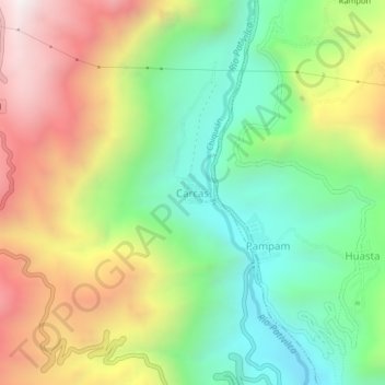
Name: Carcas topographic map, elevation, terrain.

Location: Carcas, Chiquián, Province of Bolognesi, Ancash, Peru (-10.13705 -77.18437 -10.09705 -77.14437)

Average elevation: 3,533 m

Minimum elevation: 2,999 m

Maximum elevation: 4,281 m

Gear up for your next adventure:

🧣Evaporative Cooling Towel - Beat the heat during intense summer climbs
⛺Lightweight Backpacking Tent - Compact tent for efficient hiking trips
🚑Survival Whistle - Signal for help across long distances in mountains
🏕️Camping Hammock - Integrated protection for sleeping between trees
🥾Lightweight Hiking Boots - Boots for comfort and mobility on long hikes

As an Amazon Associate, this site earns from qualifying purchases at no extra cost to you.