Geolocate

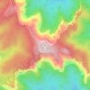
Paria River topographic map

Click on the map to display elevation.

About this map

Name: Paria River topographic map, elevation, terrain.

Location: Paria River, Kane County, Utah, United States (36.85820 -112.08299 37.65282 -111.59161)

Average elevation: 1,802 m

Minimum elevation: 947 m

Maximum elevation: 2,902 m

Other topographic maps

Click on a map to view its topography, its elevation and its terrain.
Bald Knoll

United States > Utah > Kane County

Average elevation: 2,024 m

Millet Point

United States > Utah > Kane County

Average elevation: 2,107 m

Navajo Lake Lodge

United States > Utah > Kane County

Average elevation: 2,841 m

Duck Creek Village

United States > Utah > Kane County

Average elevation: 2,608 m

Coyote Natural Bridge

United States > Utah > Kane County

Average elevation: 1,361 m

Paria

United States > Utah > Kane County

Average elevation: 1,538 m

Duck Creek Village

United States > Utah > Kane County

Average elevation: 2,608 m

Duck Creek Village

United States > Utah > Kane County

Average elevation: 2,608 m

Rainbow Point

United States > Utah > Kane County

Average elevation: 2,578 m

Gear up for your next adventure:

🧼Travel Hand Sanitizer - Keep hands clean when water is scarce
👟Sport Hiking Sandals - Breathable footwear for water crossings and camp rest
🥾Hiking Shoes - Durable and comfortable shoes for trail hiking
🛶Kayak Accessories - Essential gear for safe and fun kayaking adventures
🧭GPS Tracker - Track your location in remote areas safely

As an Amazon Associate, this site earns from qualifying purchases at no extra cost to you.