Geolocate

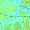
Lotus Peak topographic map

Click on the map to display elevation.

About this map

Name: Lotus Peak topographic map, elevation, terrain.

Location: Lotus Peak, Huangshan, Anhui, China (30.12706 118.16518 30.12716 118.16528)

Average elevation: 1,437 m

Minimum elevation: 925 m

Maximum elevation: 1,810 m

Other topographic maps

Click on a map to view its topography, its elevation and its terrain.
Yi County

China > Anhui > Huangshan

Average elevation: 399 m

Liyang

China > Anhui > Huangshan

Average elevation: 143 m

Xiuning County

China > Anhui > Huangshan

Average elevation: 375 m

Qimen County

China > Anhui > Huangshan

Average elevation: 344 m

Huangshan District

China > Anhui > Huangshan

Average elevation: 405 m

Gear up for your next adventure:

🥾Light Trekking Boots - Supportive boots for multi-day treks
🔦UV Flashlight - Detect minerals or specific insects in the dark
🧴Sunscreen SPF - Broad-spectrum sunscreen for outdoor activities
🧣Evaporative Cooling Towel - Beat the heat during intense summer climbs
🧦Hiking Socks - Moisture-wicking and comfortable socks for long hikes

As an Amazon Associate, this site earns from qualifying purchases at no extra cost to you.