
Buck Lake topographic map
Click on the map to display elevation.
About this map
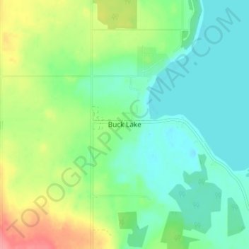
Name: Buck Lake topographic map, elevation, terrain.
Location: Buck Lake, County of Wetaskiwin, Alberta, T0C 0T0, Canada (52.93252 -114.81036 52.97252 -114.77036)
Average elevation: 901 m
Minimum elevation: 875 m
Maximum elevation: 957 m
County of Wetaskiwin trails, hiking, mountain biking, running and outdoor activities
Other topographic maps
Click on a map to view its topography, its elevation and its terrain.