
Bedugul topographic map
Interactive map
Click on the map to display elevation.
About this map
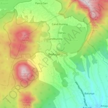
Name: Bedugul topographic map, elevation, terrain.
Location: Bedugul, Tabanan, Bali, Nusa Tenggara, 81162, Indonésie (-8.32473 115.12061 -8.24473 115.20061)
Average elevation: 1,327 m
Minimum elevation: 812 m
Maximum elevation: 2,072 m
Other topographic maps
Click on a map to view its topography, its elevation and its terrain.
Gunungsari
Gunungsari, Tabanan, Bali, Nusa Tenggara, 82152, Indonésie
Average elevation: 731 m