
Gunungsari topographic map
Interactive map
Click on the map to display elevation.
About this map
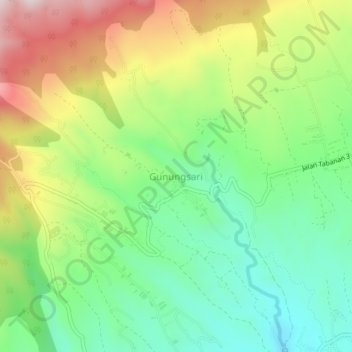
Name: Gunungsari topographic map, elevation, terrain.
Location: Gunungsari, Tabanan, Bali, Nusa Tenggara, 82152, Indonésie (-8.38161 115.11319 -8.34161 115.15319)
Average elevation: 731 m
Minimum elevation: 511 m
Maximum elevation: 1,075 m
Other topographic maps
Click on a map to view its topography, its elevation and its terrain.