Geolocate

Carthage topographic map

Click on the map to display elevation.

About this map
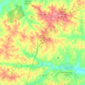
Name: Carthage topographic map, elevation, terrain.

Location: Carthage, Moore County, North Carolina, United States (35.23855 -79.44226 35.36723 -79.34362)

Average elevation: 128 m

Minimum elevation: 80 m

Maximum elevation: 181 m

Gear up for your next adventure:

🌬️Windproof Camp Stove - Efficient cooking even on exposed mountain peaks
🚲Handlebar Phone Mount - View topographic-map.com live while cycling
🛁Quick-Dry Microfiber Towel - Space-saving towel that dries rapidly on the move
🧢Sun Hat - Wide-brim hat for sun protection
🧥Ultralight Puffy Jacket - Maximum warmth that packs down to the size of an orange

As an Amazon Associate, this site earns from qualifying purchases at no extra cost to you.