
Etherington Creek Provincial Recreation Area topographic map
Interactive map
Click on the map to display elevation.
About this map
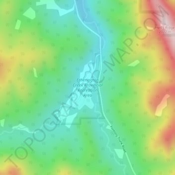
Name: Etherington Creek Provincial Recreation Area topographic map, elevation, terrain.
Average elevation: 1,749 m
Minimum elevation: 1,604 m
Maximum elevation: 2,024 m
Division No. 15 trails, hiking, mountain biking, running and outdoor activities
Other topographic maps
Click on a map to view its topography, its elevation and its terrain.
Pyramid Mountain
Canada > Alberta > Division No. 15 > Municipality of Jasper
Average elevation: 2,152 m