
Make a donation
Gear up for your next adventure:
As an Amazon Associate, this site earns from qualifying purchases at no extra cost to you.
Rolling River topographic map
Click on the map to display elevation.
Make a donation
Gear up for your next adventure:
As an Amazon Associate, this site earns from qualifying purchases at no extra cost to you.
About this map
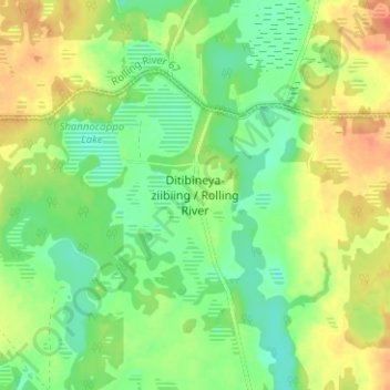
Name: Rolling River topographic map, elevation, terrain.
Location: Rolling River, Division No. 15, Manitoba, Canada (50.43345 -100.00845 50.47345 -99.96845)
Average elevation: 610 m
Minimum elevation: 590 m
Maximum elevation: 634 m
Division No. 15 trails, hiking, mountain biking, running and outdoor activities
Make a donation
Gear up for your next adventure:
As an Amazon Associate, this site earns from qualifying purchases at no extra cost to you.
Other topographic maps
Click on a map to view its topography, its elevation and its terrain.
Rowland Lake
Canada > Manitoba > Division No. 15 > Rural Municipality of Rosedale
Average elevation: 692 m
Beaufort Lake
Canada > Manitoba > Division No. 15 > Municipality of Harrison Park > Sandy Lake
Average elevation: 613 m
Make a donation
Gear up for your next adventure:
As an Amazon Associate, this site earns from qualifying purchases at no extra cost to you.
Kerrs Lake
Canada > Manitoba > Division No. 15 > Municipality of Clanwilliam – Erickson
Average elevation: 670 m
North Thomas Lake
Canada > Manitoba > Division No. 15 > Rural Municipality of Yellowhead
Average elevation: 596 m
Rural Municipality of Rosedale
Canada > Manitoba > Division No. 15 > Rural Municipality of Rosedale
Average elevation: 484 m