Geolocate

Christopher topographic map

Click on the map to display elevation.

About this map

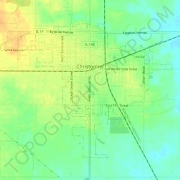
Name: Christopher topographic map, elevation, terrain.

Location: Christopher, Franklin County, Illinois, 62822, United States (37.95400 -89.07863 37.98141 -89.03230)

Average elevation: 130 m

Minimum elevation: 116 m

Maximum elevation: 145 m

Other topographic maps

Click on a map to view its topography, its elevation and its terrain.

Mulkeytown

United States > Illinois > Franklin County

Average elevation: 136 m

Gear up for your next adventure:

🥾Trekking Boots - Durable boots for long-distance trekking
🧢Beanie Hat - Keep your head warm in cold weather
🧭Orienteering Kit - Tools for map reading and navigation in the wild
👖Convertible Hiking Pants - Zip-off legs to adapt to changing weather conditions
🔦UV Flashlight - Detect minerals or specific insects in the dark

As an Amazon Associate, this site earns from qualifying purchases at no extra cost to you.