
Putumayo topographic map
Interactive map
Click on the map to display elevation.
About this map
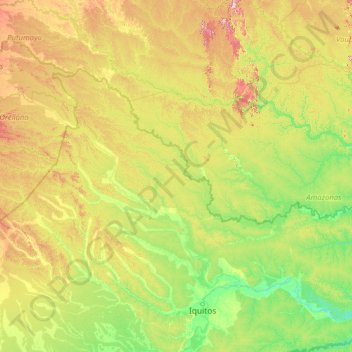
Name: Putumayo topographic map, elevation, terrain.
Location: Putumayo, Loreto, Peru (-3.42422 -75.61055 -0.03928 -70.05883)
Average elevation: 163 m
Minimum elevation: 68 m
Maximum elevation: 626 m
Other topographic maps
Click on a map to view its topography, its elevation and its terrain.
Puerto Nariño
Peru > Loreto > Puerto Nariño
Puerto Nariño, Putumayo, Loreto, Peru
Average elevation: 171 m