
Make a donation
Gear up for your next adventure:
As an Amazon Associate, this site earns from qualifying purchases at no extra cost to you.
Akersloot topographic map
Click on the map to display elevation.
Make a donation
Gear up for your next adventure:
As an Amazon Associate, this site earns from qualifying purchases at no extra cost to you.
About this map
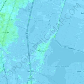
Name: Akersloot topographic map, elevation, terrain.
Location: Akersloot, Castricum, Noord-Holland, Nederland (52.53853 4.71570 52.59258 4.75708)
Average elevation: -1 m
Minimum elevation: -6 m
Maximum elevation: 6 m
Make a donation
Gear up for your next adventure:
As an Amazon Associate, this site earns from qualifying purchases at no extra cost to you.
Other topographic maps
Click on a map to view its topography, its elevation and its terrain.
Noord-Bakkum
Nederland > Noord-Holland > Castricum > Noord-Bakkum
Noord-Bakkum ligt van oorsprong aan de Duinweg, Hoogeweg en Madeweg ter hoogte van de Heerenweg. In de loop van de 20e eeuw worden ook de uitlopers van het dorp Limmen, de Zanddijk (deels) en de Limmerweg tot Noord-Bakkum gerekend. Dit deel valt dan ook deels onder Limmen. Het geheel wordt in het noorden…
Average elevation: 3 m
Make a donation
Gear up for your next adventure:
As an Amazon Associate, this site earns from qualifying purchases at no extra cost to you.