
Yenegoa topographic map
Interactive map
Click on the map to display elevation.
About this map
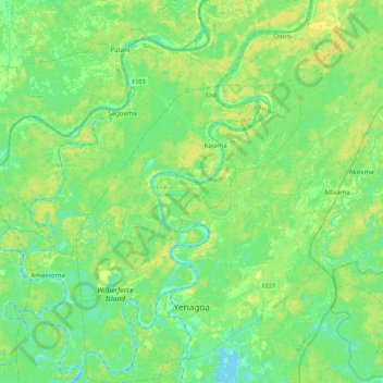
Name: Yenegoa topographic map, elevation, terrain.
Location: Yenegoa, Bayelsa State, Nigeria (4.84603 6.14736 5.28454 6.56664)
Average elevation: 8 m
Minimum elevation: -3 m
Maximum elevation: 22 m
Other topographic maps
Click on a map to view its topography, its elevation and its terrain.
Semewata
Nigeria > Bayelsa State > Ekeremor
Semewata, Ekeremor, Bayelsa State, Nigeria
Average elevation: 1 m