Geolocate

Market Drayton topographic map

Click on the map to display elevation.

About this map

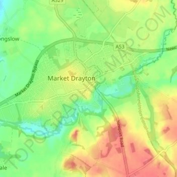
Name: Market Drayton topographic map, elevation, terrain.

Location: Market Drayton, Shropshire, England, United Kingdom (52.89205 -2.52128 52.91265 -2.46053)

Average elevation: 94 m

Minimum elevation: 65 m

Maximum elevation: 126 m

Other topographic maps

Click on a map to view its topography, its elevation and its terrain.

Ellesmere

United Kingdom > England > Shropshire

Average elevation: 94 m

Gear up for your next adventure:

🥾Lightweight Hiking Shoes - Comfortable shoes for day hikes
🛰️Satellite Messenger - Emergency communication for areas with no cell service
🥾Waterproof Hiking Shoes - Durable shoes for wet and rugged trails
🛌Insulated Sleeping Pad - Critical thermal barrier between you and the cold ground
💧Collapsible Water Bottle - Space-saving water bottle for outdoor activities

As an Amazon Associate, this site earns from qualifying purchases at no extra cost to you.