
Thank you for supporting this site ❤️
Make a donation
Make a donation
Gear up for your next adventure:
As an Amazon Associate, this site earns from qualifying purchases at no extra cost to you.
Västersjön topographic map
Click on the map to display elevation.
Thank you for supporting this site ❤️
Make a donation
Make a donation
Gear up for your next adventure:
As an Amazon Associate, this site earns from qualifying purchases at no extra cost to you.
About this map
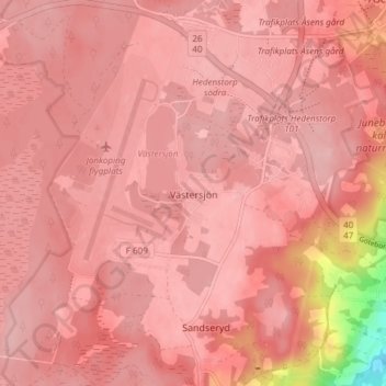
Name: Västersjön topographic map, elevation, terrain.
Location: Västersjön, Jönköpings kommun, Jönköping County, 55593, Sweden (57.73509 14.06402 57.77509 14.10402)
Average elevation: 217 m
Minimum elevation: 100 m
Maximum elevation: 236 m
Thank you for supporting this site ❤️
Make a donation
Make a donation
Gear up for your next adventure:
As an Amazon Associate, this site earns from qualifying purchases at no extra cost to you.