Geolocate

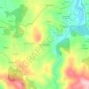
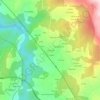
Zobra topographic map

Click on the map to display elevation.

About this map

Name: Zobra topographic map, elevation, terrain.

Location: Zobra, Lalín, Deza, Pontevedra, Galicia, España (42.53386 -8.25455 42.58807 -8.17831)

Average elevation: 692 m

Minimum elevation: 464 m

Maximum elevation: 1,001 m

Other topographic maps

Click on a map to view its topography, its elevation and its terrain.
A Goleta

España > Galicia > Deza > Lalín

Average elevation: 500 m

Samprizón

España > Galicia > Deza > Lalín

Average elevation: 669 m

Castro de Abaixo

España > Galicia > Deza > Lalín

Average elevation: 558 m

Bustelos

España > Galicia > Deza > Lalín

Average elevation: 678 m

Doade

España > Galicia > Deza > Lalín

Average elevation: 551 m

Erbo de Arriba

España > Galicia > Deza > Lalín

Average elevation: 549 m

A Estrada

España > Galicia > Deza > Lalín

Average elevation: 517 m

Palmou

España > Galicia > Deza > Lalín

Average elevation: 547 m

O Cruceiro

España > Galicia > Deza > Lalín

Average elevation: 468 m

Soutolongo de Abaixo

España > Galicia > Deza > Lalín

Average elevation: 529 m

Gear up for your next adventure:

🛶Kayak Accessories - Essential gear for safe and fun kayaking adventures
🔪Outdoor Multitool - Versatile tool for repairs and food prep in the wild
🕶️Polarized Sunglasses - Reduces glare from snow and water at high elevations
🧥Fleece Jacket - Warm and lightweight jacket for layering
🥽Outdoor Goggles - Protective eyewear for outdoor activities

As an Amazon Associate, this site earns from qualifying purchases at no extra cost to you.