Geolocate

Wulang topographic map

Click on the map to display elevation.

About this map

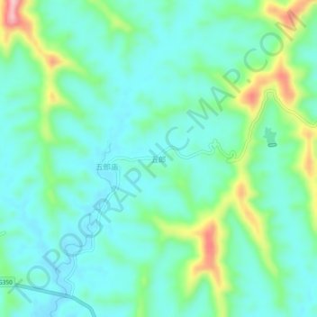
Name: Wulang topographic map, elevation, terrain.

Location: Wulang, Suining, Sichuan, China (30.53214 105.76621 30.57214 105.80621)

Average elevation: 366 m

Minimum elevation: 316 m

Maximum elevation: 524 m

Other topographic maps

Click on a map to view its topography, its elevation and its terrain.

Hesha

China > Sichuan > Suining

Average elevation: 365 m

Gear up for your next adventure:

Camping Tent - Weather-resistant tents suitable for 2 to 6 people
🧊Insulated Water Bottle - Keeps drinks cold in summer and prevents freezing in winter
📷Outdoor Action Camera - Capture high-elevation views and rugged adventures
🛌Down Sleeping Bag - Superior warmth-to-weight ratio for cold nights
🧼Travel Hand Sanitizer - Keep hands clean when water is scarce

As an Amazon Associate, this site earns from qualifying purchases at no extra cost to you.