Geolocate

Carreghofa topographic map

Click on the map to display elevation.

About this map

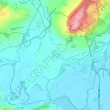
Name: Carreghofa topographic map, elevation, terrain.

Location: Carreghofa, Powys, Wales, United Kingdom (52.76659 -3.12472 52.79632 -3.08523)

Average elevation: 94 m

Minimum elevation: 63 m

Maximum elevation: 224 m

Other topographic maps

Click on a map to view its topography, its elevation and its terrain.

Llanymynech Hill

United Kingdom > Wales > Powys > Carreghofa

Average elevation: 107 m

Gear up for your next adventure:

🥘Camping Cookware Set - Compact nesting pots and pans for trail cooking
🧰Multitool Knife - Compact and versatile tool for outdoor use
🧦Outdoor Socks - Durable socks designed for hiking and outdoor sports
🔋Solar Power Bank - Keep your GPS and devices charged during long outdoor trips
🧤Insulated Winter Gloves - Heavy-duty protection for sub-zero Canadian adventures

As an Amazon Associate, this site earns from qualifying purchases at no extra cost to you.