Geolocate

Destin topographic map

Click on the map to display elevation.

About this map

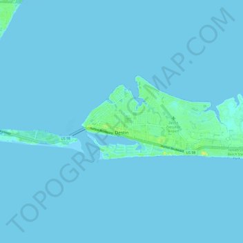
Name: Destin topographic map, elevation, terrain.

Location: Destin, Okaloosa County, Florida, 32540, United States (30.37863 -86.51588 30.41778 -86.39723)

Average elevation: 1 m

Minimum elevation: -2 m

Maximum elevation: 22 m

Other topographic maps

Click on a map to view its topography, its elevation and its terrain.

Deerland

United States > Florida > Okaloosa County

Average elevation: 63 m

Holt

United States > Florida > Okaloosa County

Average elevation: 53 m

Gear up for your next adventure:

🕶️Polarized Sunglasses - Protect your eyes with durable polarized lenses
🩹Moleskin Blister Pads - Direct protection for painful foot pressure points
🧰Emergency Multi-Tool - Compact multi-tool for outdoor survival
🧊Portable Cooler - Keep food and drinks cold during outdoor adventures
🧴Waterproofing Spray - Restore the DWR coating on jackets and tents

As an Amazon Associate, this site earns from qualifying purchases at no extra cost to you.