Geolocate

Kroh Park topographic map

Click on the map to display elevation.

About this map

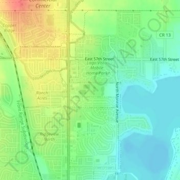
Name: Kroh Park topographic map, elevation, terrain.

Location: Kroh Park, Loveland, Larimer County, Colorado, United States (40.44533 -105.07604 40.44742 -105.06970)

Average elevation: 1,533 m

Minimum elevation: 1,512 m

Maximum elevation: 1,565 m

Other topographic maps

Click on a map to view its topography, its elevation and its terrain.

Loveland

United States > Colorado > Larimer County > Loveland > Loveland

Average elevation: 1,525 m

Gear up for your next adventure:

🥾Lightweight Hiking Boots - Boots for comfort and mobility on long hikes
🧭GPS Outdoor Watch - Smart watch for navigation and fitness tracking in nature
🥾Mountain Hiking Shoes - Shoes with superior grip for mountainous terrain
💡Portable Camping Lamp - Rechargeable lamp for campsite lighting
🔦LED Headlamp - Hands-free lighting for early morning starts or late finishes

As an Amazon Associate, this site earns from qualifying purchases at no extra cost to you.