Geolocate

Hernando topographic map

Click on the map to display elevation.

About this map
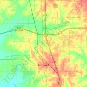
Name: Hernando topographic map, elevation, terrain.

Location: Hernando, DeSoto County, Mississippi, 38632, United States (34.79672 -90.06023 34.90433 -89.93054)

Average elevation: 96 m

Minimum elevation: 67 m

Maximum elevation: 127 m

Other topographic maps

Click on a map to view its topography, its elevation and its terrain.

West Days

United States > Mississippi > DeSoto County

Average elevation: 82 m

Gear up for your next adventure:

☕Camping Coffee Maker - Brew fresh coffee anywhere on the topographic map
🥾Approach Boots - Comfortable boots for hiking and climbing approaches
🧴Waterproofing Spray - Restore the DWR coating on jackets and tents
🧣Evaporative Cooling Towel - Beat the heat during intense summer climbs
🚑Survival Whistle - Signal for help across long distances in mountains

As an Amazon Associate, this site earns from qualifying purchases at no extra cost to you.