Geolocate

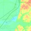
West Days topographic map

Click on the map to display elevation.

About this map

Name: West Days topographic map, elevation, terrain.

Location: West Days, DeSoto County, Mississippi, 38641, United States (34.89148 -90.11593 34.93148 -90.07593)

Average elevation: 82 m

Minimum elevation: 64 m

Maximum elevation: 107 m

Other topographic maps

Click on a map to view its topography, its elevation and its terrain.

Horn Lake

United States > Mississippi > DeSoto County

Average elevation: 92 m

Walls

United States > Mississippi > DeSoto County

Average elevation: 70 m

Olive Branch

United States > Mississippi > DeSoto County

Average elevation: 110 m

Hernando

United States > Mississippi > DeSoto County

Average elevation: 96 m

Southaven

United States > Mississippi > DeSoto County

Average elevation: 99 m

Southaven

United States > Mississippi > DeSoto County

Average elevation: 99 m

Olive Branch

United States > Mississippi > DeSoto County

Average elevation: 110 m

Hernando

United States > Mississippi > DeSoto County

Average elevation: 96 m

Horn Lake

United States > Mississippi > DeSoto County

Average elevation: 92 m

Gear up for your next adventure:

🥾Light Hiking Boots - Lightweight and comfortable boots for day hikes
🧥Softshell Hiking Jacket - The perfect balance of wind protection and breathability
☕Camping Coffee Maker - Brew fresh coffee anywhere on the topographic map
🧳Compression Sacks - Maximize space in your backpack by shrinking gear
🥾Trail Hiking Socks - Comfortable socks to prevent blisters and fatigue

As an Amazon Associate, this site earns from qualifying purchases at no extra cost to you.