Geolocate

Rewey topographic map

Click on the map to display elevation.

About this map

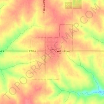
Name: Rewey topographic map, elevation, terrain.

Location: Rewey, Iowa County, Wisconsin, United States (42.83493 -90.40296 42.84926 -90.38808)

Average elevation: 333 m

Minimum elevation: 287 m

Maximum elevation: 353 m

Other topographic maps

Click on a map to view its topography, its elevation and its terrain.

Edmund

United States > Wisconsin > Iowa County

Average elevation: 351 m

Jonesdale

United States > Wisconsin > Iowa County

Average elevation: 306 m

Blue Mounds

United States > Wisconsin > Iowa County

Average elevation: 417 m

Gear up for your next adventure:

🥾Trail Hiking Boots - Supportive boots for rough trails
🔥Camping Stove - Portable stoves to cook outdoors with ease
🔨Vehicle Emergency Tool - Safety tool for remote road trips to trailheads
🥫Freeze-Dried Meals - Lightweight, high-calorie nutrition for multi-day treks
🔋Lithium AA Batteries - Long-lasting power that performs in extreme cold

As an Amazon Associate, this site earns from qualifying purchases at no extra cost to you.