Geolocate

Wilden topographic map

Click on the map to display elevation.

About this map

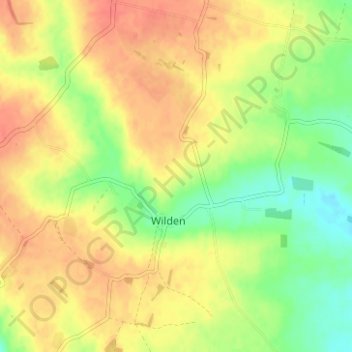
Name: Wilden topographic map, elevation, terrain.

Location: Wilden, Bedford, England, United Kingdom (52.17100 -0.42623 52.20408 -0.36376)

Average elevation: 59 m

Minimum elevation: 32 m

Maximum elevation: 79 m

Other topographic maps

Click on a map to view its topography, its elevation and its terrain.

Duck's Cross

United Kingdom > England > Bedford > Wilden

Average elevation: 52 m

Gear up for your next adventure:

🧢Outdoor Visor - Breathable visor for sunny hikes
Backpacking Tent - Lightweight tent for long-distance hiking trips
👟Sport Hiking Sandals - Breathable footwear for water crossings and camp rest
🏃Hydration Running Vest - Carry water and maps close to your body for speed
🧢Hiking Hat - Sun-protective and breathable hats for long treks

As an Amazon Associate, this site earns from qualifying purchases at no extra cost to you.