Geolocate

Le Blizon topographic map

Click on the map to display elevation.

About this map
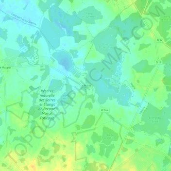
Name: Le Blizon topographic map, elevation, terrain.

Location: Le Blizon, Rosnay, Le Blanc, Indre, Centre-Val de Loire, France métropolitaine, 36300, France (46.72076 1.20386 46.76076 1.24386)

Average elevation: 98 m

Minimum elevation: 88 m

Maximum elevation: 115 m

Other topographic maps

Click on a map to view its topography, its elevation and its terrain.
Château du Bouchet

France > Centre-Val de Loire > Indre > Rosnay

Average elevation: 103 m

Gear up for your next adventure:

🛶Kayak Dry Bag - Waterproof storage for kayaking adventures
💧Hydration Bladder - Hands-free hydration solution for long treks
🧢Sun Protection Cap - Breathable cap to protect from sun exposure
🧦Outdoor Socks - Durable socks designed for hiking and outdoor sports
🧥Ultralight Puffy Jacket - Maximum warmth that packs down to the size of an orange

As an Amazon Associate, this site earns from qualifying purchases at no extra cost to you.