Geolocate

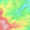
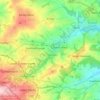
Heckmondwike topographic map

Click on the map to display elevation.

About this map
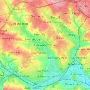
Name: Heckmondwike topographic map, elevation, terrain.

Location: Heckmondwike, Kirklees, West Yorkshire, England, WF16 0EY, United Kingdom (53.66744 -1.71545 53.74744 -1.63545)

Average elevation: 100 m

Minimum elevation: 31 m

Maximum elevation: 189 m

Other topographic maps

Click on a map to view its topography, its elevation and its terrain.
Kirkburton

United Kingdom > England > Kirklees

Average elevation: 148 m

Meltham

United Kingdom > England > Kirklees

Average elevation: 278 m

Holme Valley

United Kingdom > England > Kirklees > Holmfirth

Average elevation: 290 m

Holmfirth Branch

United Kingdom > England > Kirklees > Brockholes

Average elevation: 185 m

Mirfield

United Kingdom > England > Kirklees > Lower Hopton

Average elevation: 97 m

Denby Dale

United Kingdom > England > Kirklees > Scissett

Average elevation: 168 m

Greenhead Park

United Kingdom > England > Kirklees > Huddersfield

Average elevation: 119 m

Hey Wood

United Kingdom > England > Kirklees > Farnley Tyas

Average elevation: 186 m

Crow Nest Park

United Kingdom > England > Kirklees > Dewsbury

Average elevation: 64 m

Denby Dale

United Kingdom > England > Kirklees

Average elevation: 187 m

Gear up for your next adventure:

🏃Hydration Running Vest - Carry water and maps close to your body for speed
🥾Hiking Leggings - Comfortable leggings for outdoor activities
🛶Kayak Dry Bag - Waterproof storage for kayaking adventures
📷Outdoor Action Camera - Capture high-elevation views and rugged adventures
🧥Packable Rain Jacket - Breathable waterproof layer for unpredictable weather

As an Amazon Associate, this site earns from qualifying purchases at no extra cost to you.