Geolocate

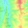
Le Beau topographic map

Click on the map to display elevation.

Le Beau

D'une longueur de 22,4 kilomètres, le Beau prend sa source sur la commune de Chillac à l'altitude 140 mètres, à l'ouest du château de Chillac. Un peu plus au nord du château, près du Grand Chiron, sa source principale est la Grand Font. Le Beau s'appelle ruisseau de la Grande Fontaine près de sa source, sur la commune de Chillac.

Wikipedia (CC-BY-SA 3.0)

About this map

Name: Le Beau topographic map, elevation, terrain.

Location: Le Beau, Saint-Bonnet, Cognac, Charente, Nouvelle-Aquitaine, France métropolitaine, 16300, France (45.37127 -0.16308 45.51654 -0.07915)

Average elevation: 92 m

Minimum elevation: 34 m

Maximum elevation: 189 m

Other topographic maps

Click on a map to view its topography, its elevation and its terrain.
Gear up for your next adventure:

🧤Thermal Hiking Gloves - Grip-enhanced gloves for cold-weather altitude trekking
🧥Fleece Jacket - Warm and lightweight jacket for layering
Bushcraft Tarp - Versatile emergency shelter or gear protection
Camping Groundsheet - Protect your tent from moisture and dirt
🥾Waterproof Hiking Boots - Essential footwear for rugged terrain and wet Canadian trails

As an Amazon Associate, this site earns from qualifying purchases at no extra cost to you.