Geolocate

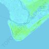
Jacksonboro topographic map

Click on the map to display elevation.

About this map

Name: Jacksonboro topographic map, elevation, terrain.

Location: Jacksonboro, Colleton County, South Carolina, 29452, United States (32.75018 -80.47455 32.79018 -80.43455)

Average elevation: 4 m

Minimum elevation: 0 m

Maximum elevation: 11 m

Other topographic maps

Click on a map to view its topography, its elevation and its terrain.

Gear up for your next adventure:

🛌Insulated Sleeping Pad - Critical thermal barrier between you and the cold ground
🗺️Topographic Maps - Detailed maps to explore trails, mountains, and wilderness areas
🛶Canoe Life Vest - Safety vest for water sports
🦌Outdoor Trail Camera - Monitor wildlife activity near your favorite spots
🧳Compression Sacks - Maximize space in your backpack by shrinking gear

As an Amazon Associate, this site earns from qualifying purchases at no extra cost to you.