Geolocate

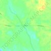
Walterboro topographic map

Click on the map to display elevation.

About this map

Name: Walterboro topographic map, elevation, terrain.

Location: Walterboro, Colleton County, South Carolina, 29488, United States (32.87028 -80.72165 32.95251 -80.63633)

Average elevation: 22 m

Minimum elevation: 3 m

Maximum elevation: 41 m

Other topographic maps

Click on a map to view its topography, its elevation and its terrain.

Gear up for your next adventure:

🪑Ultralight Camping Stool - Compact seating for rest stops during long hikes
🎒Fully Waterproof Backpack - Total protection for photography gear and electronics
🧰Survival Kit - Essential gear for emergencies in the wilderness
🧰Emergency Multi-Tool - Compact multi-tool for outdoor survival
🥾Trekking Poles - Adjustable trekking poles to reduce knee stress and improve stability

As an Amazon Associate, this site earns from qualifying purchases at no extra cost to you.