Geolocate

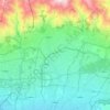
Lavasan topographic map

Click on the map to display elevation.

About this map

Name: Lavasan topographic map, elevation, terrain.

Location: Lavasan, Lavasanat, Shemiranat County, Tehran Province, 33416-81979, Iran (35.78048 51.59214 35.86048 51.67214)

Average elevation: 1,900 m

Minimum elevation: 1,530 m

Maximum elevation: 2,955 m

Other topographic maps

Click on a map to view its topography, its elevation and its terrain.

Niavaran

Iran > Tehran Province > Shemiranat County > Tehran

Average elevation: 1,804 m

Niavaran

Iran > Tehran Province > Shemiranat County > Tehran

Average elevation: 1,708 m

Tajrish

Iran > Tehran Province > Shemiranat County

Average elevation: 1,889 m

Niyavaran Park

Iran > Tehran Province > Shemiranat County > Tehran

Average elevation: 1,634 m

Jamshidieh Park

Iran > Tehran Province > Shemiranat County > Tehran

Average elevation: 1,983 m

Gear up for your next adventure:

👟Trail Running Shoes - Agile footwear for fast-paced topographic exploration
🥾Mountaineering Boots - Supportive boots for climbing and high-altitude hiking
☕Camping Coffee Maker - Brew fresh coffee anywhere on the topographic map
🪜Heavy Duty Carabiners - Multi-use clips for securing gear to your backpack
🧢Hiking Sun Hat - Wide-brimmed protection for exposed mountain ridges

As an Amazon Associate, this site earns from qualifying purchases at no extra cost to you.