
Tajrish topographic map
Click on the map to display elevation.
About this map
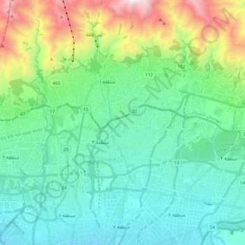
Name: Tajrish topographic map, elevation, terrain.
Average elevation: 1,889 m
Minimum elevation: 1,300 m
Maximum elevation: 3,540 m
Other topographic maps
Click on a map to view its topography, its elevation and its terrain.
Tochal
Iran > Tehran Province > Shemiranat County > دهستان رودبار قصران
Tochal (Persian: توچال Točāl), is a mountain and ski resort located on the Alborz mountain range, adjacent to the metropolitan area of Tehran in northern Iran. It includes a 12-kilometre-long (7.5 mi) ridge. Its highest peak, also called Tochal, is at an elevation of 3,963 metres (13,002 ft) above sea level.
Average elevation: 3,561 m
لواسان بزرگ
Iran > Tehran Province > Shemiranat County > دهستان لواسان بزرگ
Average elevation: 2,357 m
Pas Ghaleh
Iran > Tehran Province > Shemiranat County > دهستان رودبار قصران
Average elevation: 2,246 m