Geolocate

Ashley Heath topographic map

Click on the map to display elevation.

About this map

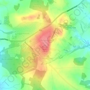
Name: Ashley Heath topographic map, elevation, terrain.

Location: Ashley Heath, Newcastle-under-Lyme, Staffordshire, England, TF9 4QR, United Kingdom (52.91836 -2.37989 52.91846 -2.37979)

Average elevation: 192 m

Minimum elevation: 153 m

Maximum elevation: 240 m

Other topographic maps

Click on a map to view its topography, its elevation and its terrain.

Gear up for your next adventure:

🚲MTB Frame Bag - Carry tools and maps directly on your bicycle frame
🥾Trail Hiking Socks - Comfortable socks to prevent blisters and fatigue
Lightweight Camping Tent - Portable shelter optimized for Canadian backcountry camping
🔦LED Flashlight - Powerful and long-lasting flashlight for camping and emergencies
🥾Trail Hiking Shoes - Durable shoes designed for rugged trails

As an Amazon Associate, this site earns from qualifying purchases at no extra cost to you.