Geolocate

Sutton Valence topographic map

Click on the map to display elevation.

About this map
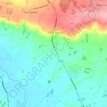
Name: Sutton Valence topographic map, elevation, terrain.

Location: Sutton Valence, Maidstone, Kent, England, United Kingdom (51.17303 0.56566 51.23009 0.60679)

Average elevation: 55 m

Minimum elevation: 14 m

Maximum elevation: 145 m

Gear up for your next adventure:

⛺Camping Groundsheet - Protect your tent from moisture and dirt
🩹Compact First Aid Kit - Pre-packed essentials for common trail injuries
👖Convertible Hiking Pants - Zip-off legs to adapt to changing weather conditions
🧤Insulated Winter Gloves - Heavy-duty protection for sub-zero Canadian adventures
🔭Outdoor Binoculars - Lightweight binoculars for birdwatching and hiking

As an Amazon Associate, this site earns from qualifying purchases at no extra cost to you.