Geolocate

Galmpton topographic map

Click on the map to display elevation.

About this map

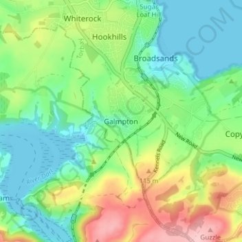
Name: Galmpton topographic map, elevation, terrain.

Location: Galmpton, Torbay, England, TQ5 0NJ, United Kingdom (50.37523 -3.58558 50.41523 -3.54558)

Average elevation: 57 m

Minimum elevation: -2 m

Maximum elevation: 168 m

Other topographic maps

Click on a map to view its topography, its elevation and its terrain.

Brixham

United Kingdom > England > Torbay

Average elevation: 38 m

Gear up for your next adventure:

🧰Survival Kit - Essential gear for emergencies in the wilderness
🥾Trail Running Boots - Durable shoes designed for trail running
🧭GPS Tracker - Track your location in remote areas safely
🦶Hiking Shoe Insoles - Added support for high arches and long days on feet
🐕Hiking Dog Pack - Let your canine companion carry their own water and food

As an Amazon Associate, this site earns from qualifying purchases at no extra cost to you.