Geolocate

Elton Green topographic map

Click on the map to display elevation.

About this map
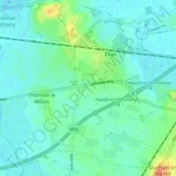
Name: Elton Green topographic map, elevation, terrain.

Location: Elton Green, Elton, Cheshire West and Chester, England, CH2 4LQ, United Kingdom (53.24776 -2.84062 53.28776 -2.80062)

Average elevation: 12 m

Minimum elevation: 3 m

Maximum elevation: 43 m

Other topographic maps

Click on a map to view its topography, its elevation and its terrain.

Gear up for your next adventure:

🎒Backpack Rain Cover - External shield to keep your entire pack dry
🧣Evaporative Cooling Towel - Beat the heat during intense summer climbs
💡Portable Camping Lamp - Rechargeable lamp for campsite lighting
🧭Orienteering Kit - Tools for map reading and navigation in the wild
🛶Waterproof Dry Bags - Keep electronics and clothes dry during river crossings

As an Amazon Associate, this site earns from qualifying purchases at no extra cost to you.