Geolocate

Rawdon topographic map

Click on the map to display elevation.

About this map

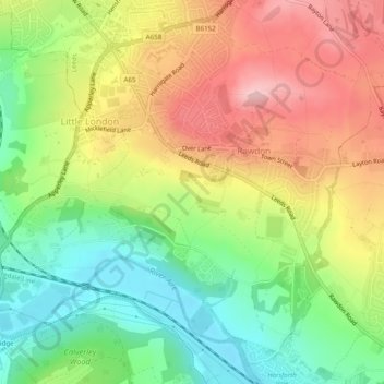
Name: Rawdon topographic map, elevation, terrain.

Location: Rawdon, Leeds, West Yorkshire, England, United Kingdom (53.83413 -1.70505 53.86007 -1.65634)

Average elevation: 131 m

Minimum elevation: 43 m

Maximum elevation: 232 m

Other topographic maps

Click on a map to view its topography, its elevation and its terrain.

Rawdon Crematorium

United Kingdom > England > Leeds > Rawdon

Average elevation: 120 m

Gear up for your next adventure:

🦶Hiking Shoe Insoles - Added support for high arches and long days on feet
🕶️Polarized Sunglasses - Reduces glare from snow and water at high elevations
💧Hydration Bladder - Hands-free hydration solution for long treks
🧦Crew Hiking Socks - Comfortable socks for long-distance hikes
🧊Insulated Water Bottle - Keeps drinks cold in summer and prevents freezing in winter

As an Amazon Associate, this site earns from qualifying purchases at no extra cost to you.