Geolocate

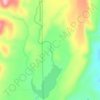
Banded Peak topographic map

Click on the map to display elevation.

About this map

Name: Banded Peak topographic map, elevation, terrain.

Location: Banded Peak, Archuleta County, Colorado, United States (37.10440 -106.62703 37.10450 -106.62693)

Average elevation: 3,557 m

Minimum elevation: 3,114 m

Maximum elevation: 3,889 m

Other topographic maps

Click on a map to view its topography, its elevation and its terrain.

Pagosa Springs

United States > Colorado > Archuleta County

Average elevation: 2,244 m

Pagosa Springs

United States > Colorado > Archuleta County

Average elevation: 2,244 m

Pagosa Springs

United States > Colorado > Archuleta County

Average elevation: 2,244 m

Pagosa Springs

United States > Colorado > Archuleta County

Average elevation: 2,244 m

Dutton Creek

United States > Colorado > Archuleta County

Average elevation: 2,387 m

Gear up for your next adventure:

⛺Camping Essentials - All-in-one gear for a comfortable camping trip
🧤Thermal Hiking Gloves - Grip-enhanced gloves for cold-weather altitude trekking
🥾Waterproof Hiking Shoes - Durable shoes for wet and rugged trails
🥾Hiking Gaiters - Protect legs and shoes from mud, snow, and debris
🧭GPS Handheld Device - Reliable GPS navigation for outdoor adventures

As an Amazon Associate, this site earns from qualifying purchases at no extra cost to you.