Geolocate

Kyllburg topographic map

Click on the map to display elevation.

About this map
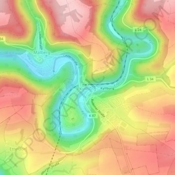
Name: Kyllburg topographic map, elevation, terrain.

Location: Kyllburg, Bitburger Land, Eifelkreis Bitburg-Prüm, Rijnland-Palts, Duitsland (50.02664 6.58018 50.05597 6.61793)

Average elevation: 372 m

Minimum elevation: 257 m

Maximum elevation: 469 m

Other topographic maps

Click on a map to view its topography, its elevation and its terrain.

Gear up for your next adventure:

🥾Trekking Poles - Adjustable trekking poles to reduce knee stress and improve stability
🛶Kayak Dry Bag - Waterproof storage for kayaking adventures
🧥Waterproof Pants - Keep dry during rainy hiking conditions
🔋Lithium AA Batteries - Long-lasting power that performs in extreme cold
🥾Mountain Hiking Boots - High-traction boots for rocky terrain

As an Amazon Associate, this site earns from qualifying purchases at no extra cost to you.